While Hurricane Imelda is not forecast to make landfall in the United States, its effects are being felt along much of the East Coast, from the Southeast through the Mid-Atlantic and into New England. Heavy surf, rip currents, and elevated tides are expected to continue as the storm tracks through the Atlantic.
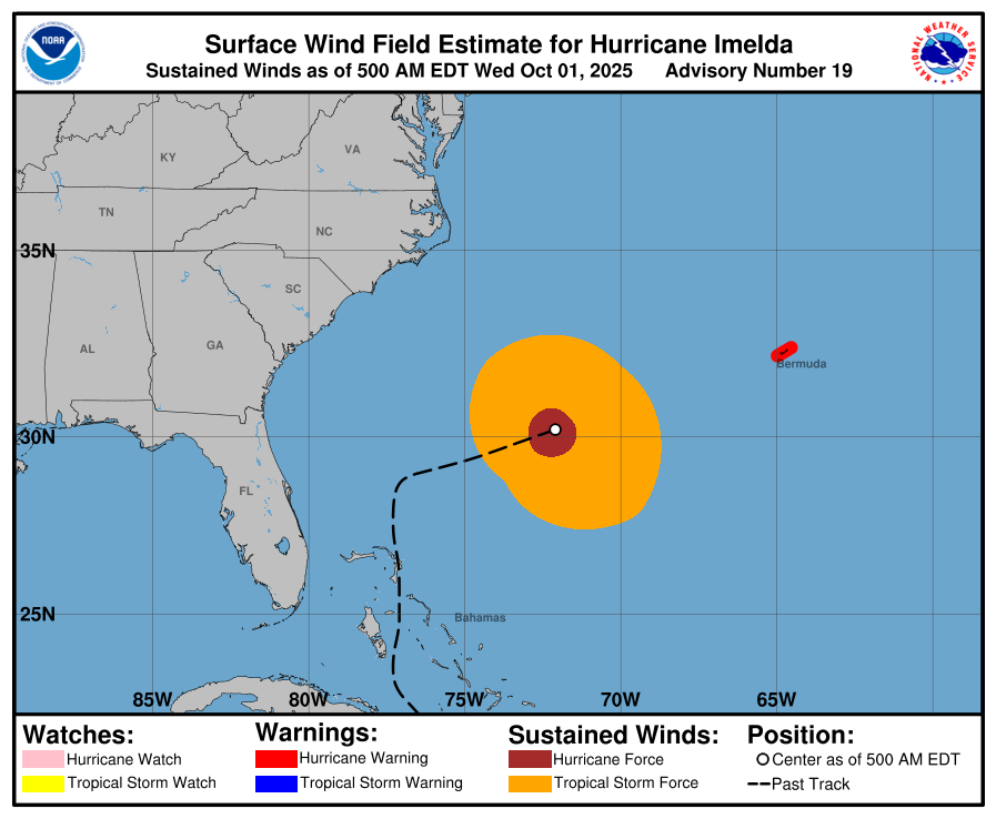
Imelda strengthened on Wednesday as it moved closer to Bermuda, where residents were rushing to finish preparations ahead of hurricane conditions. According to the National Hurricane Center (NHC), the storm is moving east-northeast at roughly 20 mph, with a faster motion anticipated over the next two days.
On its current path, the core of Imelda is expected to pass near Bermuda by Wednesday afternoon or evening before moving away by Thursday. A Hurricane Warning is in effect for the island, meaning hurricane-force winds and life-threatening storm surge are expected. Forecasters warn of massive waves and the potential for coastal flooding across Bermuda.
Meanwhile, a second system is churning in the Atlantic. Hurricane Humberto, which rapidly intensified over the weekend into a Category 5 hurricane before weakening, is now classified as a Category 1 storm.
As of early Wednesday morning, Humberto was located about 280 miles north-northwest of Bermuda with maximum sustained winds near 80 mph and higher gusts. While some weakening is expected, the storm is forecast to remain strong before merging with a frontal boundary Wednesday night.
The NHC reports that there are currently no coastal watches or warnings in effect for Humberto.
Residents across the U.S. East Coast are being advised to stay alert for dangerous surf and rip currents as both hurricanes continue to influence weather conditions in the Atlantic Basin.

Comments